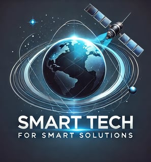
تمكين عملك من خلال أحدث الحلول والتصوير عبر الأقمار الصناعية
نقدم صورًا عالية الجودة من الأقمار الصناعية، مصحوبة برؤى ذكية وقابلة للتنفيذ، لتمكين عملائنا. تُحسّن حلولنا المبتكرة العمليات، وتُعزز عملية اتخاذ القرارات، وتُساعد على تحقيق الأهداف بدقة وكفاءة. من خلال الاستفادة من التكنولوجيا المتقدمة والاستراتيجيات الذكية، نُمكّن الشركات من البقاء في الطليعة، وتحقيق نجاح مستدام ونتائج أكثر ذكاءً في جميع القطاعات.
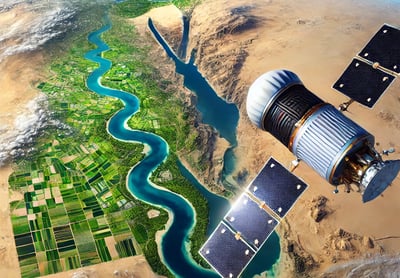
صور أقمار صناعية دقيقة بدقة عالية تصل إلى 30 سم. مثالية للمراقبة والتحليل واتخاذ القرارات بوضوح ودقة لا مثيل لهما. صور بدقة عالية تصل إلى 30 سم.
منتجات معالجة الصور والتصوير الفوتوغرامتري التي تستغل قوة صور الأقمار الصناعية عالية الدقة لإنشاء نماذج ثلاثية الأبعاد وقياسات دقيقة لسطح الأرض.
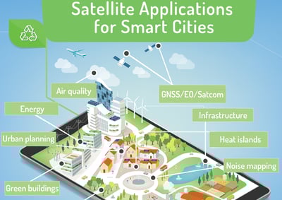
تدعم حلولنا المتطورة التطبيقات في التخطيط الحضري وتطوير البنية التحتية ومراقبة البيئة والمزيد، مما يوفر الوضوح والتفاصيل التي تحتاجها لاتخاذ قرارات مؤثرة

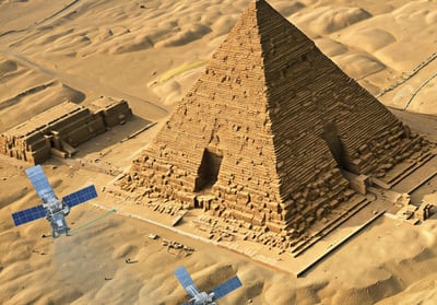
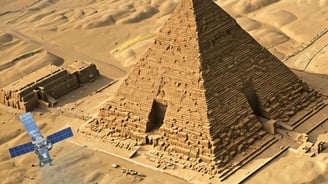
توفر صور أقمارنا الصناعية رؤيةً لا مثيل لها للأحداث على الأرض وفي البحر، موفرةً الدقة والتردد والنطاقات الطيفية والدقة والأرشيف التاريخي اللازم لدفع عجلة الابتكار وحل التحديات المعقدة. بفضل تقنيتنا المتطورة، ستكتسبون الرؤى اللازمة لرصد وتحليل ومعالجة القضايا الحرجة في مختلف المجالات بدقة وموثوقية.
خبراء التسويق عبر الأقمار الصناعية
تحويل صور الأقمار الصناعية إلى رؤى قابلة للتنفيذ لتحقيق النجاح ونمو أعمالك.
حلول التسويق المستهدفة


استراتيجيات مخصصة لتعزيز الرؤية والمشاركة من خلال تسويق صور الأقمار الصناعية.


رؤى تعتمد على البيانات
استخدام التحليلات المتقدمة لتوفير رؤى قيمة من صور الأقمار الصناعية لاتخاذ قرارات مستنيرة.
يقدم فريقنا ذو الخبرة نتائج استثنائية مصممة خصيصًا لتلبية احتياجاتك التسويقية الفريدة.
فريق من الخبراء المتخصصين
مشاريعنا
اكتشف مشاريعنا التسويقية الناجحة في خدمات صور الأقمار الصناعية.


تحليل الأقمار الصناعية
تحويل بيانات الأقمار الصناعية إلى رؤى تسويقية قابلة للتنفيذ للعملاء.


معالجة الصور
تحسين صور الأقمار الصناعية بخبرة لتحقيق اتصال بصري أكثر وضوحًا.


دراسات وتحليل السوق
تحليل متعمق لاتجاهات السوق باستخدام بيانات صور الأقمار الصناعية.
التعاون مع العملاء
العمل بشكل وثيق ومباشر مع العملاء لتحقيق نتائج استثنائية معًا.

خبرة
تحقيق نتائج استثنائية في تسويق صور الأقمار الصناعية.
تواصل معنا
التواصل
+20 10 979 555 6
© Smart Tech for smart solutions 2025. All rights reserved.